
A recent report says Chinese scholars at a 30 June 2026 symposium at Jinan University claimed that China has sovereignty over Batanes, describing the islands as a “natural geographical extension” of Taiwan.
Philippine Defense Secretary Gilberto Teodoro rejected the claim as baseless and ludicrous, while the Department of Foreign Affairs stated that Philippine sovereignty over Batanes is settled and not open to debate.
The claim is so flimsy that even a small eighteenth-century print helps expose the problem. This is one of those occasions to prove that art history can also be a tool for rebuffing foolish geopolitical claims.
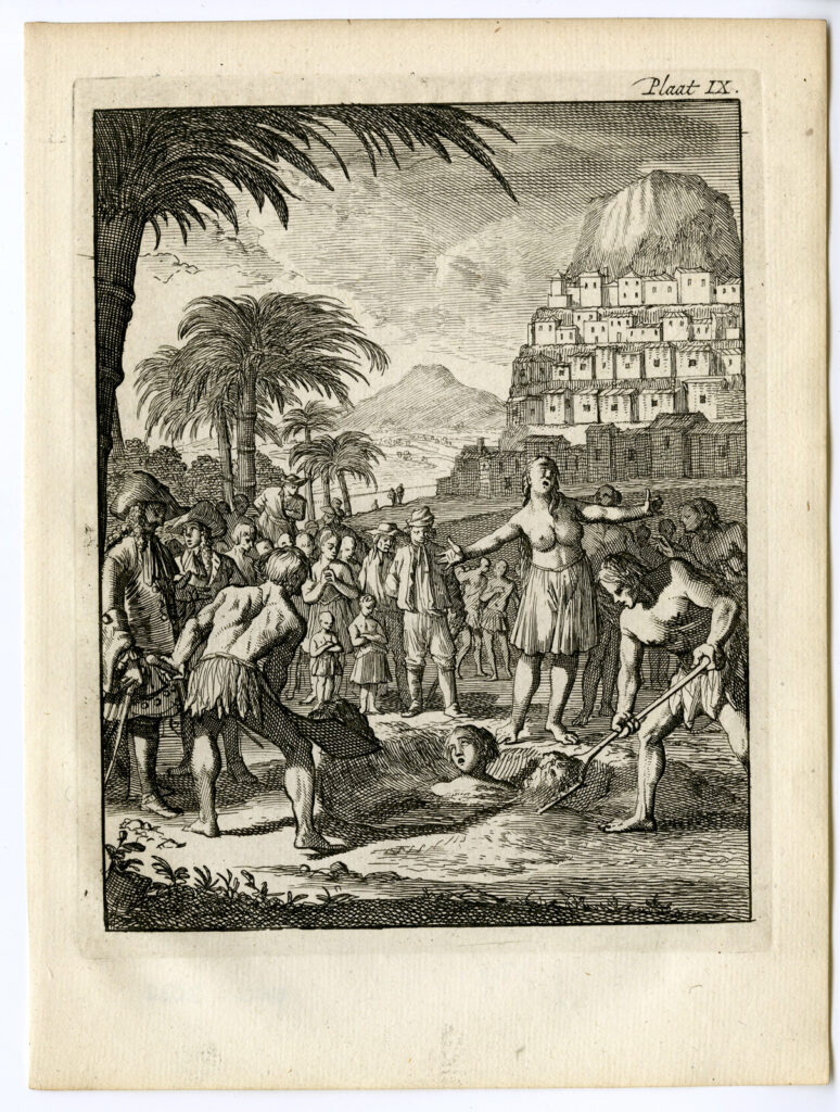
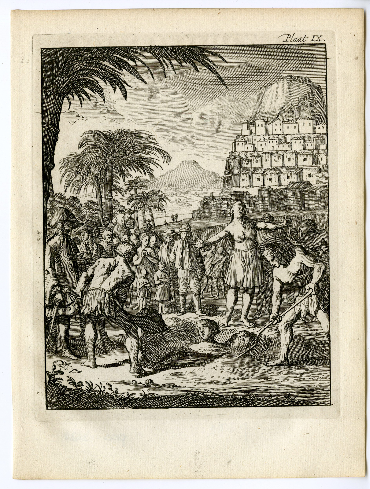
This print (see above), Plaat IX, shows a scene in the Basjee or Bashee Islands, an early European name for what is now Batanes. It was published in the 1771 Dutch edition of William Dampier’s travel account, Nieuwe Reistogt rondom de Wereld. The design is attributed to Caspar Luyken, a Dutch engraver who died in 1708, which means the image itself cannot have been newly engraved in 1771. The work was likely an older plate or design reused in that later edition.
The print depicts a punishment scene: a man buried in the sand, a crowd of onlookers, a woman lamenting at the center, and a settlement rising behind them. Historian José Victor Torres has suggested that the settlement depicted here may be an ijang. Ijangs are the terraced hillfort settlements of the Ivatan people, built atop hills and ridges throughout the Batanes Islands. These elevated rocky strongholds served as fortresses and places of refuge, offering protection against enemy attacks. These elevated rocky strongholds served as fortresses and places of refuge, offering protection against enemy attacks. European visitors appear at the left, framing the scene as a spectacle of local life viewed through the eyes of a foreigner.
The print also preserves an important geographic name. Here, Basjee or Bashee clearly refers not to China, but to the Ivatan island world north of Luzon, distinct from Taiwan.
What makes Luyken’s image so striking is its representation of Batanes as an Ivatan polity governed by its own customary laws and systems of punitive justice.
In the language of territorial and property law, the scene may be read as evidence of active or actual possession: the physical occupation, use, and visible control of a geographic territory. The print therefore records more than a theoretical or historical claim, offering visual evidence of the exercise of jurisdiction and authority in a region whose sovereignty would later become contested.
To make the point more concrete, Dampier’s original 1687 account framed his voyage through Mindanao, “other Philippine and East India islands,” China, Formosa, Luconia, Celebes, and surrounding seas, distinguishing these places rather than collapsing them into a single regional space.
To be clear, Batanes was not yet formally part of the Spanish Philippines when Dampier visited in 1687, and it was not Chinese either. It was Ivatan first: an Indigenous maritime society in the Luzon Strait, connected to nearby islands linguistically and by established sea routes.
Under Governor-General José Basco y Vargas, Spanish authorities sent an expedition in 1782, and on 26 June 1783, representatives of the Spanish Crown and Ivatan leaders carried out formal rites of annexation. The new colonial province was named Provincia de la Concepción. In the 243 years since that date, no Chinese claim to Batanes has been raised or recognized. Sovereignty over the islands passed on to the Republic of the Philippines at the end of American occupation on July 4, 1946. The People’s Republic of China was born on October 1, 1949.
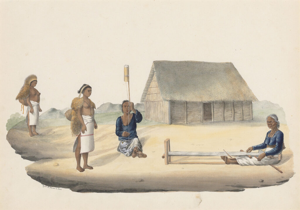
A later image by José Honorato Lozano, Spinning and Weaving, Batanes, Northern Philippines, with Ivatan Women Wearing Vakuls, c. 1840 extends this visual record of Ivatan life. Signed “Jose H. Lozano lo Pintó” at lower left, the work depicts women engaged in spinning and weaving while wearing the distinctive vakul, grounding Batanes in recognizable practices of labor, dress, and material culture.
Together with Luyken’s earlier print, it presents the islands not as an empty or indeterminate territory, but as an inhabited Ivatan world shaped by its own social customs, technologies, and forms of communal life.
No comparable prints or visual records supports a Chinese claim.
On the contrary, Caspar Luyken’s print is just one among many art-historical documents that helps clarify why such a claim has no historical basis. Batanes was never a blank extension of Taiwan or China. As the print shows, it was an Indigenous island world later incorporated into the Philippines through Spanish colonial administration.
Philippine Defense Secretary Gilberto Teodoro was right to vehemently rebuff current claims over Batanes as baseless and ludicrous, and the visual archive gives us another way to see why.
Geronimo Cristobal is an international correspondent for the Philippines Graphic.

Geronimo Cristóbal
Geronimo Cristóbal is a lecturer in Art History at Ateneo de Manila University, and a PhD candidate in the History of Art and Archaeology at Cornell University. He serves as an international correspondent for the Philippines Graphic. He can be reached at gc448@cornell.edu.