

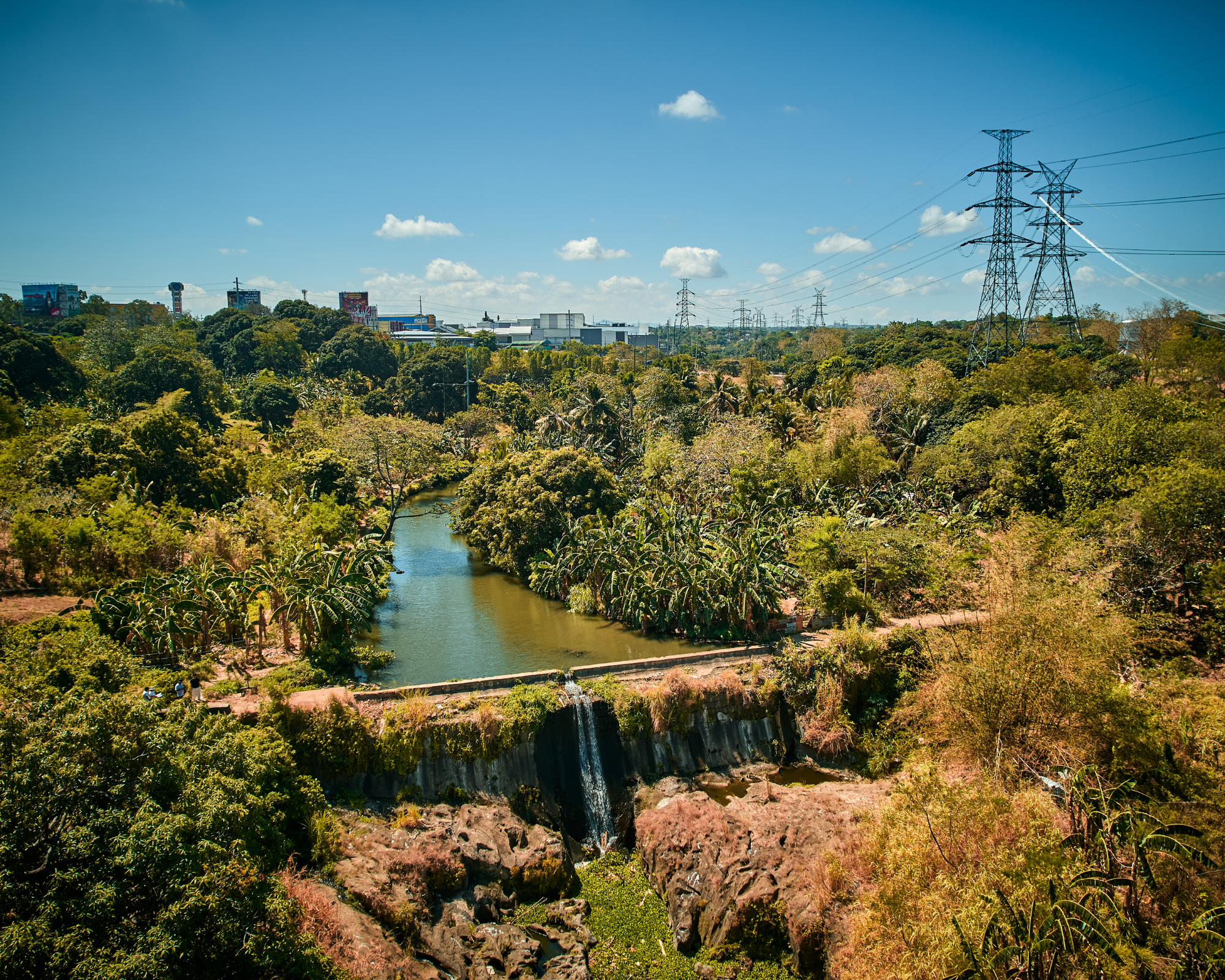
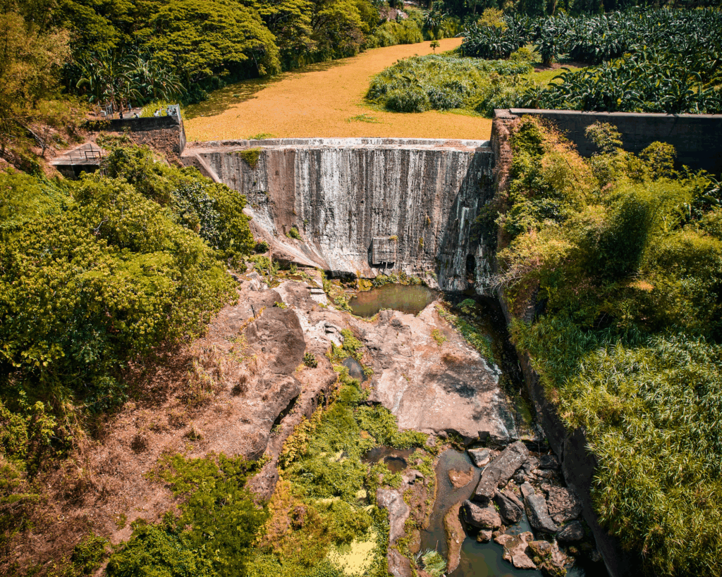
Hacienda de Imus is home to the earliest known irrigation system in Cavite. Its oldest surviving structure, the Casundit Dam in Dasmariñas, was constructed by the Augustinian Recollects in 1780 and remains the oldest dated extant dam in the Philippines. This historical footnote serves as an important anchor for this exhibition on the irrigation and agricultural history of Cavite.
PATUBIG: Cavite’s Heritage Irrigation Systems is now on display at the Museo de La Salle which is housed within De La Salle University–Dasmariñas (DLSUD). The exhibit offers a renewed cultural understanding of Cavite’s landscape through its Spanish built water infrastructures. Through photographs, maps, and archival materials, it traces the history of irrigation systems that once sustained the province’s rice fields, revealing how water shaped settlement, agriculture, and everyday life in the province.
These extensive hydraulic systems built during the Spanish colonial period—channeled water across friar estates and agricultural lands and enabled large-scale farming of rice and sugarcane, while also sustaining surrounding communities. Water not only irrigated fields but structured settlement patterns, organized daily life, and underpinned the province’s economic landscape.
The exhibition was the brainchild of Aidel Belamide, a trustee of the Cavite Historical Society and a member of Sangguniang Panlalawigan, representing the 5th district of Cavite. In partnership with DLSU-D, he began the project in December 2025 with a multidisciplinary team assembled to develop the exhibition using archival documents, maps, photographs, videos, and drone footage.
Belamide said “there is a pressing need to mount this exhibition because of the immense historical and heritage value of Cavite’s irrigation systems. These structures are not only significant historical landmarks but also important testimonies to the ingenuity of earlier generations in managing water resources.”
He cites for example, the Casundit Dam in Dasmariñas dates back to the eighteenth century, while the Bancud Dam in Indang—together with its underground tunnels and aqueducts—was regarded as an engineering marvel in the nineteenth century.
Mary Ann Salvador, Museo De La Salle Director, who was part of the exhibition team, said the process of putting the show together is a rediscovery of Cavite Province holds a rich history beyond the well-known battles of the Revolution.
“Besides religious influence and before the full establishment of government control, the friars were also involved in addressing essential community needs such as patubig,” Salvador said.
It gives viewers a more informed understanding of the expansive geography of friar lands, where religious orders once administered vast agricultural estates. In the case of Cavite, the exhibition reveals how this landscape was carefully partitioned and shaped through the overlapping forces of agriculture, labor, and irrigation.
Key materials were sourced from the Cavite Studies Center, including archival maps, estate cartographies from the Cesar Virata Collection, Belamide’s research, and those of heritage documentarian Kristian Noe Romanes, while recent fieldwork coordinated with the National Irrigation Administration documented 13 historic dams across Cavite through photography and aerial imaging.
The project also serves as a cultural mapping initiative for Cavite, building upon the pioneering research of E.A. Sembrano, whose comprehensive study of irrigation systems in Cavite and Laguna remains a key reference in the field. His NHCP-published work, Presa: The History and Heritage of Spanish Colonial Dam Building in the Philippines, 1689–1898, provides essential documentation and historical data that significantly informed the exhibition, particularly in the profiling of each featured dam. The organizers acknowledge his scholarship as an invaluable foundation for the project.
The exhibition is carefully organized into distinct sections. One section examines the extent of friar lands on which these irrigation systems and dams were established. Another highlights the material fabric of these works, focusing on the construction methods and materials used in their making. Central to the presentation is a mapping of surviving dams, alongside an assessment of the various risks they currently face.
Digital overlays were employed to connect these archival systems to the present-day geography of towns and roads, exposing both continuity and rupture: the same waterways that once sustained farms now run beneath asphalt, subdivisions, and altered terrain we see today.
The exhibition also addresses the current condition of this heritage through a section focused on risk and continuing loss of the significant heritage structures. It aims to frame the dwindling number of these irrigation systems as both physical loss and a decline in historical awareness.
Despite these dam’s historical, scientific, and cultural significance, many of these irrigation systems have fallen into neglect. Among these, the Quintana Dam has been abandoned, the Balayungan Dam has had several of its air shafts covered by a subdivision road, and the Tres Cruces Dam is suffering from severe siltation that threatens its operation. Their deteriorating condition underscores the urgent need for conservation and rehabilitation.
“Through this exhibition, we hope to encourage individuals and institutions to take a more active role in the preservation of this heritage, especially in supporting efforts to nominate these irrigation systems as National Cultural Treasures,” said Salvador.
The exhibition runs until August 31, 2026. —Philip Paraan

Started in 1927, the Philippines Graphic is the longest-running printed magazine of national circulation that provides relevant news and features and promotes Philippine literature.